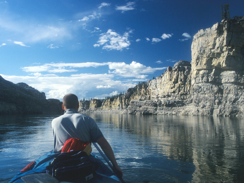
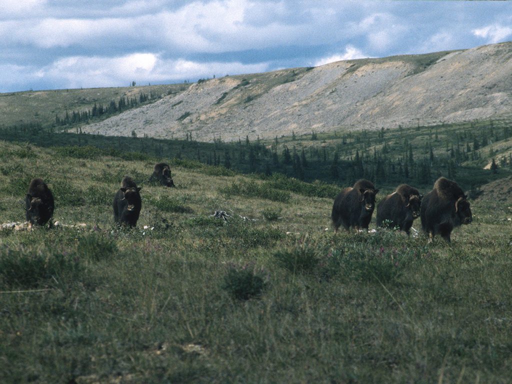
Two dark brown masses moved slowly over the smooth treeless hill in the distance as our heavily‑laden red canoe slipped through the silence along the clear, cold river. We followed the rippling wake to shore and stealthily hiked along a sunken stream bed toward the snorts and grunts that occasionally interrupted the buzz of mosquitoes around us.
Halfway up the slope, we peered up from the waist‑deep trench and reeled back at the sight of more than 30 shaggy muskoxen grazing on the green tundra carpet not more than 100 metres away. No sooner had I pulled out my camera than the herd formed a defensive guard around the calves while the group’s massive bearded leader stared us down. I glanced around and gulped ‑ there wasn’t a single tree or boulder in sight to hide behind should the horned beast decide to charge.
Slowly, we backed down the hill and pushed the canoe into the water, leaving the animals in peace. It was then, on Day Two of a two‑week 250‑kilometre journey down the Horton River, that the reality of paddling in the high Arctic finally sunk in. I shook with the delight of a child as the current took us further into this strange new place.
A two‑hour flight from Inuvik over hundreds of small emerald lakes that cover the flat endless landscape had brought my friend Glenn and I to the Horton River, which begins at Horton Lake about 700 kilometres northwest of Yellowknife and flows for 600 kilometres northwest to Franklin Bay on the coast of the Beaufort Sea.
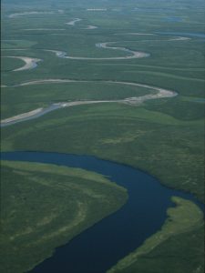 The Horton is remote, even by northern standards. The Inuit of Paulatuk, the nearest community, 100 kilometres due east, rarely venture there and not many canoeists paddle the river either, mainly because it can be an expensive undertaking. But those who make the effort will be rewarded with spectacular scenery and excellent wildlife viewing opportunities on a swift, and mostly clear river. A day earlier, we were delivered by floatplane to a tiny unnamed lake a short portage from our put-in near Whaleman River. The lake provided such a short take‑off area, the pilot had to try four times before finally getting back in the air. We watched the plane slowly disappear as the moon rose into the still bright sky. After months of planning, this was finally it ‑ the beginning of the trip of a life time. I felt more alive than ever but I also knew that we were utterly alone to fend for ourselves in this vast wilderness.
We chose to begin our trip in mid‑July when the water level is still relatively high, the days are 24 hours long and the sun is at its warmest. Average temperatures range from 3 to 13C but on a few days we guessed the thermometer rose to 25C. For those reasons, it’s the best time to go but the unpredictable Arctic weather system can also bring snow squalls, freezing rain and thunderstorms, even though the Horton flows through two semi‑arid climate zones. We were sometimes forced to don wool hats and gloves to keep warm while paddling, but it was the wind that proved to be our toughest hardship ‑ howling so strong for two days that walking the canoe along the rocky shore was quicker than paddling – we had to keep moving or miss the pilot on our prearranged pick‑up day.
The Horton is a very good choice for beginners on a guided trip or intermediate canoeists who want to go it alone as we did, since it’s a relatively easy paddle. There are only a few sets of rapids along the whole river and all can be portaged. Most of the whitewater runs through a beautiful canyon section several kilometres long where steep brown cliffs and sedimentary rock steps rise up on both sides of the river. Our confidence level rose as we scouted then successfully ran each one.
On the last set, our canoe flipped as we attempted to go over a chute. I tumbled into the swirling white foam and thrashed to the surface, only to discover the canoe was stuck in the recirculating current at the bottom of the chute with me. I quickly pulled on the boat. The washing machine released its hold and I roller-coastered through a stretch of large waves with my hand gripping the canoe in front of me.
It was then that I noticed the froth exploding up above a drop dead ahead ‑ ready to suck the canoe and me in, possibly forever. My adrenaline surged and, using all of my strength, I managed to heave the canoe out of the rushing current and onto shore with only moments to spare. I lay on a rock ledge gasping for air, wondering if Glenn was safe. After catching my breath, I jumped back in the water and fought my way back upstream along a cliff wall until I found him just as bruised and bewildered as I was. Thankfully, he had made it to shore safely just after we dumped. Afterwards, I shuddered to think of the deep trouble an injury or pinned boat would have caused so far from civilization. It was a lesson well learned ‑ always err on the side of caution and portage if there is even the slightest doubt that a rapid can be run safely.
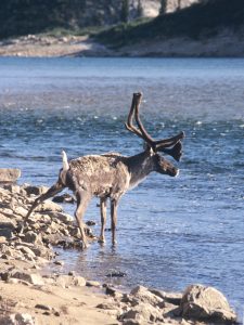 Once out of the canyon, the current calms, the land opens up and the wildlife presents itself more readily. We began seeing more birds, such as young Bald eagles, Arctic loons, Gyrfalcons and Peregrine falcons fly overhead. A few times, grizzly bears swaggered towards our camp only to venture off in surprise as soon as they detected our scent. Pikas, small squirrel‑like rodents, were less afraid and often came right up to us in search of food. On one hot and sunny afternoon, we watched several haggard caribou swim across the river just ahead of our canoe and we pulled up on a sandy beach to investigate. Caribou tracks covered an entire half‑kilometre stretch of the shore ‑ we knew we had just missed a great migratory spectacle. Each year, sometime between July and August, thousands of post‑calving caribou herd migrate to the coastline to feed.
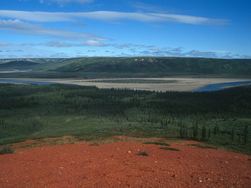
Soon after, the river becomes slow and shallow as it snakes by steep, sandy slopes, steel‑grey deposits of sedimentary rock called alluvial fans, and lowland fields interspersed with the odd stunted spruce tree. Welcome to the true barren lands, a place, I’ll admit, I didn’t much like camping in that first night. There were few good places to pitch a tent since the ground was bone hard and uneven, the mosquitoes were unrelenting, and being out in the open made me feel totally exposed to the weather and animals. Everything exists on such a grand scale in the Far North that I felt totally insignificant and defenseless. Never before on any canoe trip had I felt so uneasy. At least firewood was plentiful, something that is never a problem since there’s a constant supply of driftwood along the way.
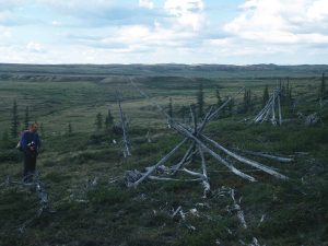 The following day, with our tent and sleeping bags in tow, we decided to stretch our legs and explore the land. We trudged up a steep slope to an immense flat plateau that was a scramble of sedge tundra made up of willows, cotton grass, dwarf birch and Labrador tea. Frequent potholes and a suffocating number of mosquitoes and flies made the going hard. Small glacial lakes broke up the uneven earth. Up on higher ground, we discovered the skeleton of an old teepee‑style tent still standing. We wondered if it was once used by the Hareskin Indians, who were among the first North American native peoples to venture into the Horton River region. That night, under the faded orange glow of the sun, we stared in awe for hours out over the endless land where few people have ever walked. I began to feel more comfortable with my surroundings.
It took little imagination to envision what life would have been like for people such as Manitoba-born explorer Vilhjalmur Stefansson who extensively explored the Horton River valley between 1908 and 1912 and documented his travels in a book called My Life With An Eskimo. At a section where the river splits into many channels and gravel bars, we discovered remnants of an old food cache, traps, and the corner of a rudimentary log cabin, and were convinced they once belonged to Stefansson.
As we paddled further above the Arctic Circle, the wind began to blow cooler and different varieties of birds began to appear. Arctic terns hovered over the water with short wing beats and then dove straight into the river for fish, while plovers and mergansers stayed close to shore. We dug our paddles in deeper during the day and repaired our weather-battered gear at night with duct tape, rope and a little ingenuity. The lingering light helped us get the chores done, but it also turned our sleeping schedule upside down since the sun dipped below the horizon for only a half hour each day. Without watches, we can only guess that we stopped paddling around midnight much of the time and slept until noon.
It was certainly hard for me to close my eyes with the constant, breathtakingly vibrant, multi‑coloured sunsets and rises that flooded the sky around us. Further downstream, the scenery changed once again as a time‑worn landscape of grey, brown and red rock exposed itself on the shores while the surrounding lichen‑covered land resembled a boundless golf course green. The river turned muddy and we knew we were nearing the coast and entering the Badlands, where the river cuts through an expanse of light brown rocky valleys devoid of any vegetation.
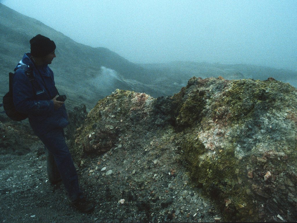
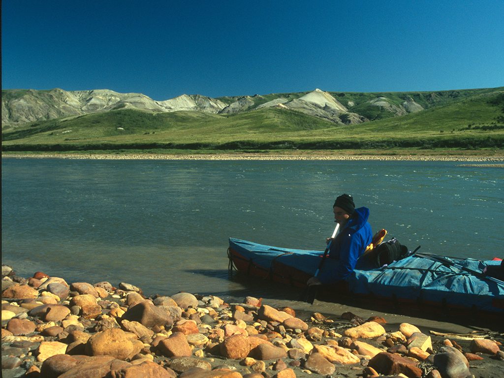 The Smoking Hills lie just after, only a kilometre south of the Beaufort Sea. Here, vast deposits of lignite, a rock that spontaneously combusts when exposed to oxygen, produces a constant smoke from fissures in the ground. In 1850, when Captain Robert McClure vainly searched the coastline of the Horton River area for the lost Franklin expedition, he thought the smoke came from campfires.
I vividly remember paddling under a blue sky one minute then, the next, into smoke that floated eerily over the widening river like a dark mist. We paddled around another long bend, and a cold wind suddenly hit us, raising whitecaps everywhere. The smoke thickened into a dark grey curtain, blocking out the sun’s rays as the pungent smell of sulphur filled my lungs. The waves continued to build, throwing our canoe all around as we continued into the darkness, nervously anticipating a dump in the cold water. I half‑expected sea serpents to snap our canoe in half like a twisted scene from Homer’s Odyssey.
After about half an hour, a plastic storage container suddenly came into view through the smoke about 50 metres away and we paddled relentlessly toward it until we touched the safety of a beach, which we later learned was a make‑shift airstrip. Exhausted and shivering with cold, we made a fire and climbed into our sleeping bags, surrounded by wolf and grizzly bear tracks and the thick cloud that turned the day into night.
The next morning, we awoke to a blue sky and walked along a stream into the Smoking Hills through foggy meadows of lapland rosebay and Arctic white heather until we came upon a slope where red, yellow and black chasms spewed a thick, toxic smoke. My throat began to feel sore from the sulphur as we continued down to the Beaufort Sea and touched its frigid grey waters. A wall of fog obscured nearly everything but the closest waves that lapped the rainbow‑coloured rocks underfoot.
After 13 days on the Horton, it was time to get to Franklin Bay where our charter float plane would pick us up. The wind was finally blowing our way, so I made a half‑hearted sail from a tarp, which worked well until the wind started shifting. We packed in the sail and paddled in perfect rhythm to the sea near a Dew Line Site that now stands abandoned.
It was only about an hour before our float plane landed. We loaded up and after several thwarted take‑off attempts due to a nasty cross‑wind, were on our way back to Inuvik. We flew over drifting ice floes out at sea, past the Smoking Hills, and then over the Horton River, exhausted, caked in dirt and basking in the recollection of our adventures.
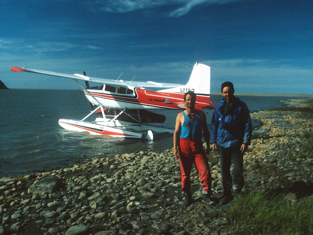 “Flying can be quite dangerous up here,” the pilot suddenly exclaimed, interrupting our contemplation. “Two of the company’s aircraft crashed while you were gone ‑ one lost all power and flipped, and the other ran out of fuel.” Glenn and I looked at each other. All I could think about was getting back to Inuvik in one piece after all that had happened on the river. When we finally landed, I winked at Glenn, then asked the pilot whether I should still recommend his aircraft company to others after all he told us.
“I got you home, didn’t I?” he replied with a mischievous grin. I knew what he meant.
Story by Ralph Plath
Photos by Ralph Plath
Getting There
The communities of Inuvik and Normal Wells and the city of Yellowknife are the most popular departure points for chartering a floatplane to the Horton River.
From Inuvik – Aklak Air
– wsebsite – http://www.aklakair.ca/
From Norman Wells – North Wright Airways
– website – http://www.north-wrightairways.calls.net
First Air and Canadian North offers scheduled flights to Inuvik and Yellowknife from Edmonton. Canadian North also has scheduled flights to NormanWells, or you can drive to either Yellowknife or Inuvik.
Guided Trips
Several companies offer two and three-week trips, including:
Nahanni River Adventures
– website – https://nahanni.com/
– tel. – 1-800-297-6927
Canoe North Adventures
– website – http://canoenorthadventures.com/
– tel. – 1·519·941·6654
If you are going on your own, an Internet search of departure communities will lead you to several companies that rent equipment such as canoes. Don’t forget to register all those on the canoe trip with the RCMP at the closest community to your departure.
Further Reading:
Canoeing Canada’s Northwest Territories, A Paddlers Guide, 1995. Published by the Canadian Recreational Canoe Association.
The Horton River, Northwest Territories River Profiles, Department of Resources, Wildlife and Economic Development (Tourism Section)
